

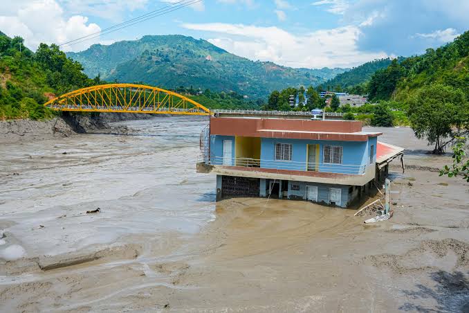
KUALA LUMPUR: The deadly flash floods and debris flow that struck mountainous areas along the Nepal-Tibet border were not caused by an earthquake, but by a massive glacier collapse in Tibet, according to updated scientific assessments.
Initial reports had linked the disaster to a magnitude 4.4 earthquake. However, analysis by the United States Geological Survey (USGS) and experts from ICIMOD found no tectonic earthquake. Instead, a huge mass of ice and rock collapsed into the Lhende Khola catchment area, temporarily blocking the river before the natural dam burst and sent a wall of water and debris, reportedly reaching up to nine metres, towards Nepal’s Rasuwa and Nuwakot districts.
Wisma Putra has confirmed that 56 Malaysians remain unreachable in the affected areas. Communication has been severely disrupted by widespread power outages and damage to telecommunication towers, bridges and mountain roads. So far, there has been no official confirmation of any Malaysian fatalities.
The Malaysian Embassy in Kathmandu is coordinating with hospitals to identify injured victims evacuated by military helicopters, while an additional diplomatic officer has been sent from the Malaysian High Commission in Dhaka to strengthen consular assistance.
Across Nepal and Tibet, the official death toll has risen to more than 160, with hundreds of people still reported missing. At least 19 bridges have been swept away, major transport routes have been cut off, and damage to six hydropower plants has affected more than 430 MW of generating capacity.
